Monday, April 14, 2014

Climate Change Impacts and Mitigation


The following information was taken from the 2007 Intergovernmental Panel on Climate Change. Click here for the IPCC's "Climate Change 2007:Working Group I: The Physical Science Basis" webpage.I have linked each reference on this page directly to the specific page sited in the assessment report.

Regional Climate Change Projections
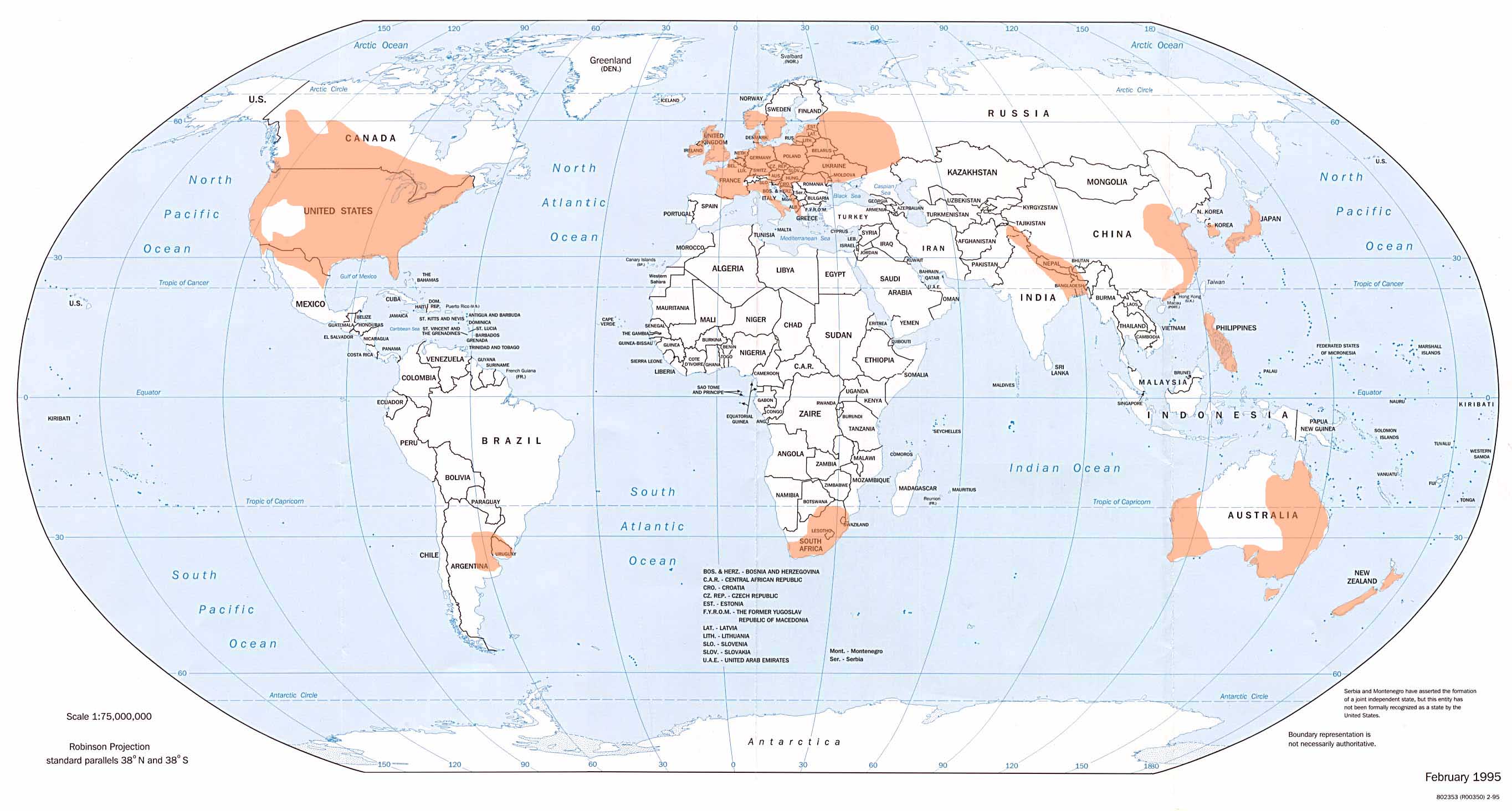
Projected Climate Change for the Caribbean is relatively interesting. This particular area is unique because it  shares features with both the Continental United States and with Central America.  As a result, the region may experience a change in climate that is very different from the popularly publicized global warming woes (such as extensive flooding). Most scientific models predict that there will be a decrease in precipitation for the entire Caribbean region (IPPC, 2007). A 2006 study found "a modest but statistically significant summer drying trend over recent decades in the Caribbean in several observational data sets" (IPPC, 2007). This is a particularly disturbing trend for nations like Haiti that are heavily agricultural.
Image taken from the IPCC's "Climate Change 2007:Working Group I: The Physical Science Basis." These are images of change in precipitation for the region calculated for the region. 
While scientists have noticed an obvious sea level rise at about 30S for the region, they are uncertain about making projections for future sea level changes (IPPC, 2007). Therefore, it is difficult to make an educated guess how much the shorelines for the Caribbean islands will be altered from rising sea levels. Also, scientists are uncertain "about the changes in frequency and intensity of 
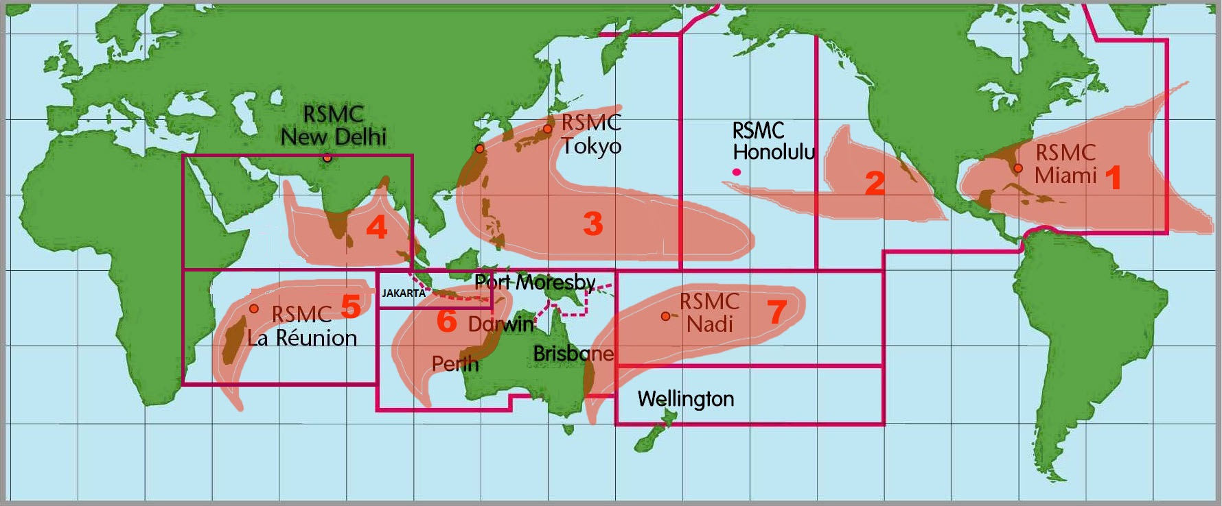
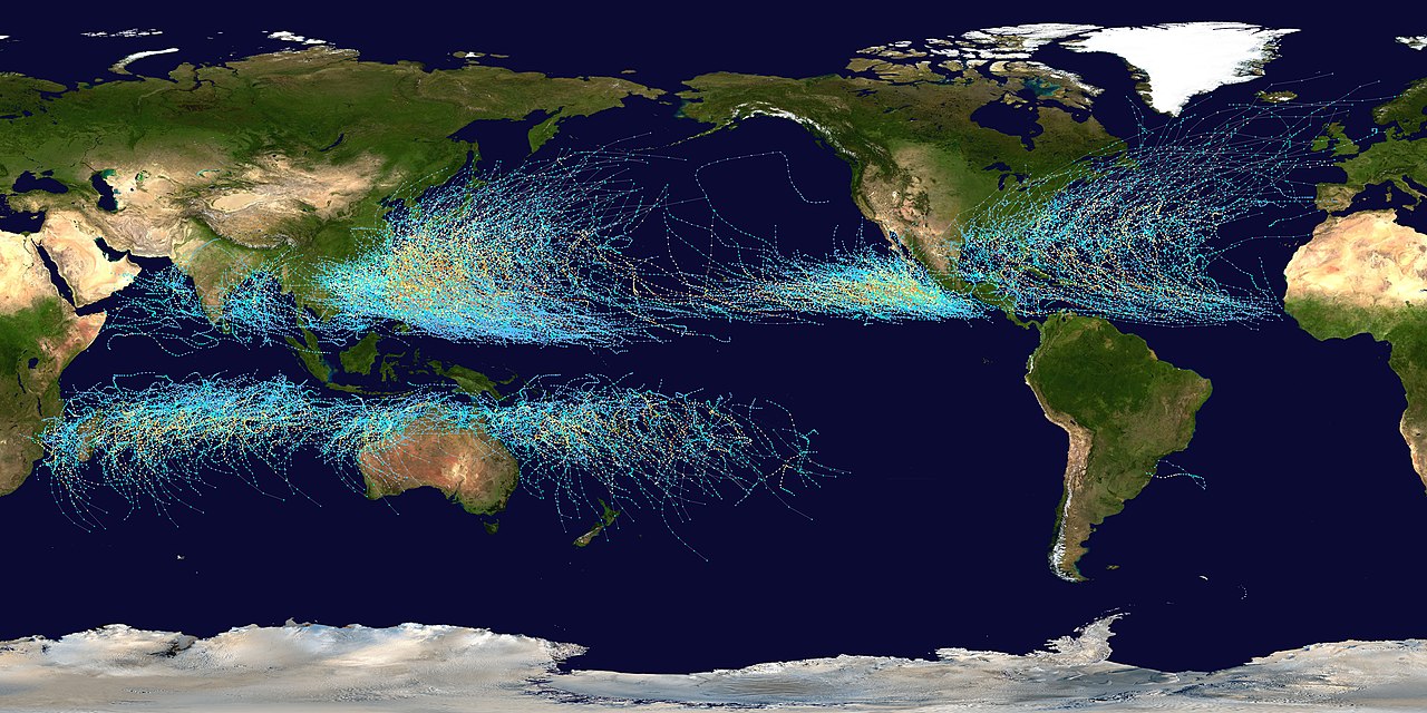
tropical cyclones on a regional basis than for temperature and precipitation changes" (IPPC, 2007). Depending on how warm the ocean becomes and if the region for hurricane formation changes in the future, Haiti could face more or less hurricanes in the future.
From United Nations Photo on flikr. Here, Jordanian UN soldiers help orphans in the aftermath of hurricane Ike. Scientists are uncertain if more hurricanes make landfall on Hispaniola due to Climate Change. 
 Specific Climate Impacts:
(For this particular section, I used this page about specific climate impacts for small islands from IPCC 2007 Report’s Working Group II:  Impacts, Adaptation, and Vulnerability: Summary for policymakers. This section of the report did not feature specific page of Climate Change impacts for the Caribbean region.)
Overall, small islands-- whether in the Caribbean or in the North Sea-- will be heavily impacted from Global Climate Change, such as "sea-level rise and extreme events." Island economies are expected to decline due to the "[d]eterioration in coastal conditions;" industries that will be effected are fishing and tourism. "Sea-level rise is expected to exacerbate inundation, storm surge, erosion and other coastal hazards, thus threatening vital infrastructure, settlements and facilities that support the livelihood of island communities."  Islands in the Pacific and Caribbean are projected to face water shortages "during low-rainfall periods." An island's ecosystem "particularly [...] mid- and high-latitude islands" will be altered due to "increased invasion by non-native species" influenced by increasing temperatures. (IPCC, 2007)  
Detailed Look at Future Climate: 
Scientists estimate that there is a moderate chance that the occurrence of  infectious disease will  increase on small islands due to climate change. Outbreaks, such as the Haitian malaria outbreak in 2006, will increase.  "Other climate-sensitive diseases of concern to small islands include diarrhoeal diseases, heat stress, skin diseases, acute respiratory infections and asthma. The observed increasing incidence of many of these diseases in small islands is attributable to a combination of factors, including poor public health practices, inadequate infrastructure, poor waste management practices, increasing global travel, and changing climatic conditions" (IPCC, 2007). 
Photo by "audra k." on flikr. An informative poster in creole about preventing malaria. Cases of malaria in Haiti may increase due to climate change. 
As previously stated, the Caribbean region is expected to experience water shortages. "Under all Special Report on Emissions Scenarios (SRES) scenarios, reduced rainfall in summer is projected for this region, so that it is unlikely that demand would be met during low rainfall periods. Increased rainfall in winter is unlikely to compensate, due to lack of storage and high runoff during storms."  In addition to water loss, "[s]ea-level rise, inundation, seawater intrusion into freshwater lenses, [and] soil salinisation [...] are very likely to adversely impact coastal agriculture." Other possible outcomes for the future climate are: increased likelihood of sea-level rise and "vulnerability" to natural disasters, reduction in the size of islands (affecting infrastructure), decline of local fisheries, loss of native species,  and negative effects on the tourism industry. (IPCC, 2007)

Most Interesting Threat:
 Personally, I find that the most interesting threat to the Caribbean is a decrease in tourism. I enjoyed taking Macro and Micro economic courses in university, and believe that trade is an important tool for improving the welfare of mankind.  Therefore, I understand that an decline in a nation's economy will lead to a decrease in  welfare for all citizens. "Small economies are generally more exposed to external shocks, such as extreme events and climate change, than larger countries, because many of them rely on one or a few economic activities such as tourism or fisheries"(IPPC, 2007). In general, islands in the Caribbean rely heavily on tourism, unlike BRIC or North American economies. Caribbean islands are well known as a popular travel destination, often portrayed as sunny tropical locales with beautiful beaches. These beaches, however, are expected to change or disappear due to sea-level rise. "Shortage of water and increased risk of vector-borne diseases may steer tourists away from small islands, while warmer climates in the higher-latitude countries may also result in a reduction in the number of people who want to visit small islands in the tropical and sub-tropical regions" (IPPC, 2007). With a decrease in tourism,  small island nations could experience national economic crises. This is, however, a bit of an overstatement. If island governments are wise, they could potentially soften the potential economic blow by various means tailored to their own economy (IPPC, 2007). 

Sunday, April 6, 2014

Severe Weather in Haiti


The following post will discuss tornadoes and hurricanes. Tornado and hurricane formation and frequency on the Continental US will be compared to Haiti's tornado and hurricane frequency.


 Tornadoes: 
    Tornadoes are created during intense thunderstorms. Tornadoes are air rotating rapidly around a narrow region of low pressure. This center of low pressure can be as low as 900mb. A tornado's wind speed can be between 70-300 mph. There a three steps to tornado development. The first step involves forming a rotating body of air at the surface (vortex tube). Vertical wind shear helps the vortex tube to start spinning. The change in wind speeds with increasing height helps to keep the storm strong. During the next step, the horizontal vortex tube is lifted off of the ground by a thunderstorm's updraft. (The updraft lifts the rotating column of air similar to human lifting a cat.) The rotating column of air is pulled into the thunderstorm. A mesocyclone develops in the updraft of the thunderstorm once the rotating column of air is vertical. During the third step, a the rotating vertical column of air's circumference contracts, increasing wind speeds. The vertical column of air then descends from the mesocyclone's wall cloud. The mesocyclone becomes a thunderstorm once the vertical column of air touches the ground (Small, J.; Lecture 18). 
    In the US, tornadoes can travel in any direction. However, many tornadoes travel southwest to northeast, or from west to east. Robert Edwards of the Storm Prediction Center at NOAA, claims that tornadoes tend to travel in a dominant direction due to "an increased frequency of certain tornado-producing weather patterns (say, hurricanes in south Texas, or northwest-flow weather systems in the upper Midwest" (The Online Tornado FAQ, NOAA).
    While tornadoes are common on the Continental Untied States, they are a rarity in the Caribbean. As of 2000, no known tornadoes have occurred on the island of Hispaniola. (However, tornadoes have occurred on other islands of the Caribbean, such as Cuba.) (The Tornado Project). According to NOAA, the yearly average number of tornadoes in the US is over 1,000 (NOAA), while the  yearly average number of hurricanes in Haiti is zero (The Tornado Project).  
A map of Global tornado occurrences (Wikipedia).
        Above is a global map of tornado occurrences, featuring areas denoting tornado "hot spots" shaded in orange. Hispaniola and the entire Caribbean are not shaded, insinuating that the region is not a tornado "hot spot." Therefore, the region rarely, if ever, experiences tornadoes. Almost the entire Continental United States, however, is shaded orange. According to a graph released by NOAA, the US Annual Tornado Count has been steadily increasing. This might, however, not be true, as technology has improved to detect tornadogenesis has dramatically improved over the past 30 years. Prior to such advancements, scientists could not possibly know about every single tornado that hit the US (including uninhabited areas). The increase in number of observed tornadoes may be due to the fact that scientists can now detect, track, and study tornadoes in more detail now than they previously could.


Hurricanes:

   Hurricanes need three "ingredients" in order to form: warm ocean temperatures greater than 27°C (>80°F), the Coriolis effect, and a deep layer of ocean water (about 200 m in depth). Therefore, the prime areas for hurricane formation occur between 20 and 5 N/S, respectively. 
  Hurricanes are called by different names in different formation regions. In the Atlantic and Pacific (1 and 2 on the map below), these storms are called hurricanes. In the Indian Ocean and in the areas surrounding Australia and La Réunion (4,5,6,7 on the map), these kinds of storms are called cyclones. Typhoons form off of China's coast (3, on the map). The term used internationally for hurricanes is Tropical Cyclone (Small, J.; Lecture 20). 

A map showing the formation regions of tropical cyclones, with labeled RSMCs (Wikipedia).
An exhaustive map showing tropical cyclone paths. Note how tropical cyclones in the Northern Hemisphere tend to curve to the left upward, while tropical cyclones in the Southern Hemisphere curve to the opposite way. (Wikipedia)
      In the United States, hurricanes tend to travel Northward up the East Coast. Tropical storms in the Atlantic tend to develop off of the Western Coast of Africa, travel to the Caribbean, and turn up the US Atlantic Coast (see the above map for marked paths of tropical cyclone storms). Hurricanes tend to travel up the Atlantic Coast because the Gulf Stream (aka North Atlantic Drift) flows upward from the Gulf of Mexico along the East Coast. Hurricanes, fueled by the warm water beneath, are directed from above by the West-Easterly flow of the region's Jet Streams and Westerlies up the East Coast (Small, J.; Lecture 20).

    Like the US East Coast, hurricanes have impacted Haiti in the past, and will affect Haiti in the future. (Click here to learn more about how hurricanes impact the well-being of Haitian citizens.) Many hurricanes travel over or by Haiti before going north and making landfall on the Continental United States (please see the exhaustive map of tropical cyclone paths above). The average number of hurricanes that appear each year in the Atlantic basin is 6.3. Interestingly, the average number of hurricanes that make landfall on the Continental US each year is 1.7 (Hurricane Research Division, NOAA), while the average annual number of hurricanes that make landfall on Hispaniola is one (Klose, C.). 

Tuesday, March 18, 2014

Daily Weather in Haiti

Five Day Forecast for Port-au-Prince:
The following is a five day forecast for Haiti's capital city, Port-au-Prince. The five day forecast will cover the following days: March 18, 2014; March 19, 2014; March 20, 2014; March 21, 2014; March 22, 2014. The forecasted high for March 18, 2014, is 88°F, with a forcasted low of 77°F. The precipitation percent for March 18 is 15%. The forecasted high for March 19, 2014, is 88°F; the forecasted low is 77°F. The precipitation percent is 16%. The forecast for March 20 is: a forecasted high of 88°F, a forecasted low of 77°F, and a precipitation percent of 16%. The forecast for March 21, 2014 is: a forecasted high of 87°F, a forecasted low of 77°F, and a precipitation percent of 18%. A high of 87°F, a low of 77°F, and a precipitation percent of 19 is forecasted for March 22, 2014. (wunderground.com


Current Satellite Image:
Screenshot from WunderMap, taken March 18, 2014.
 Above is a satellite image taken of Haiti, with a market over Port-au-Prince. Grey and white shaded areas represent low, warm clouds whilst blue clouds represent high, cold clouds. Coming in from the Dominican Republic are high clouds. There are situated in the North-East part of Haiti. Low, warm clouds are lightly scattered throughout the country: some are located in the center of the island nation, while others are resting over South-Eastern coast. 
Screenshot taken March 18, 2014, from WunderMap
This next image is a satellite image of Port-au-Prince. To be quite honest, I'm not sure if there are thin, low warm clouds over the capital or if there is heavy pollution, as Port-au-Prince and its surrounding neighborhoods are densely populated. The green areas on the map represent forests. 

Regional (Synoptic) Patterns of Low and High Pressure and Fronts:
From Intellicast. Screenshot taken March 18, 2014
Above is a map of the Caribbean. Observed isobar pressures are: 1016 mb over Florida, 1016 mb North East of the Hispaniola and Porto Rico, and 1012 mb off of the coast of Central America. High and Low pressures are not present of this particular map. A cold front located over Cuba from Florida moves toward Hispaniola.
From Intellicast. Screenshot taken March 18, 2014.

On the larger map of the Continental US, several low and high pressure areas are present. In respect to the Caribbean region, there is a high in the Gulf of Mexico near Louisiana and Florida, and a Low off the coast off of Virginia and North Carolina. Also, there is a high present over North Carolina. The Cold front over Cuba is a part of a mid-latitude cyclone (the center of which is the low off of the coast of Virginia and North Carolina). Another mid-latitude cyclone is approaching the end of its "life" over Kansas and Missouri.

Wednesday, March 12, 2014

Global and local winds in Haiti

Location and Global Wind:
Haiti is located at a latitude of 19° 00' N and a longitude 72° 25' W (Maps of the World). Therefore, the island nation is located in both Northern and Western hemispheres (worldatlas), and resides within the Hadley cell. Due to the fact that Haiti is located towards the middle of the Hadley cell, the nation is located south of the Horse latitudes and north of the Equator, receiving north-easterly trade winds (click here for a visual representation). Besides the north-easterly trade winds, Haiti experiences winds from other directions. From April to June, the prevailing winds are from the Northeast. Winds from October to November are from the Northwest (Woods, C.). Haiti is located south of the subtropical high and north of the ITCZ, a low pressure zone (click here for a visual). Haiti is not located near either of the pressure belts: Haiti is located at a latitude of 19° 00' N, while the ITCZ is located at a latitude of 5° 00' N/S (geography.about.com) , and the subtropical high pressure belt is located at the latitude of 30° 00' N. Therefore, one could argue that Haiti is located slightly closer to the subtropical high pressure belt than the ITCZ. Another important factor to note is that Haiti is in-between the Horse latitudes (30° 00' N) and the doldrums (0° 00', or the Equator).  While Haiti's geographic position is somewhat closer to the Northern Horse latitude than to the doldrums, Haiti is not as affected by these two special forces as other areas (such as Florida or French Guiana) are.

Global Wind and Weather:
Image from Wikipedia
As previously stated, Haiti lies towards the center of the Northern Hadley cell. Due to its distance from the Equator and Sub-tropical high, Haiti experiences a warm, tropical, humid climate with high rates of precipitation. Separation from the polar fronts prevents Haiti from experiencing seasonality like other nations located within the mid-latitude cells. Seasons, therefore, are mild. Trade winds help to regulate Haiti's climate, bringing cool air from the north-east over Hispaniola. Rain shadows exist in Haiti due to orographic lifting on the leeward side of the island, which is a part of the Dominican Republic (Woods, C.).  Hispaniola's position within the Hadley cell and distance from the Equator and Sub-tropical high also affects its weather. Precipitation that occurs within the area is rain, formed mainly by the collision-coalescence process. Tropical storms can also effect the area, as such storms form over the warm tropical waters of the region.

Local Winds:
Topographic characteristics determine the types of local winds experienced in a geographical area. In Haiti, there are three main mountain regions, with two minor ranges and a lone peak. In northern Haiti lies the Chaine du Haut Piton; the Massif de la Selle runs southeast of the capital, Port au Prince. The southwestern end of the nation features the Massif de la Hotte. Two other mountain ranges, the Massif des Montagnes Noires and Chaine des Cahos, also are present in Haiti, as well as the lone mountain Montagne Terrible (Maps of the World). Winds or breezes have been associated with mountain ranges worldwide. Five types of breezes or winds are associated with mountains: Katabatic winds, Chinook or Foehn winds, valley breeze, mountain breeze, and Santa Ana winds. Haiti can and does experience several of these winds. Valley and mountain breezes can form in any area with valley walls. Haiti does also experience the effects of Chinnok winds,as Haiti part of Haiti is in the rain shadow of the Dominican Republic. The island nation does not experience Santa Ana winds or Katabatic winds: these types of winds are dependent on a geographic location (near a desert or near an Arctic tundra) that do not exist in Haiti. While topography can generate local winds experienced in an area,  being located near a body of water can also generate local winds as well. Haiti's coastline borders with the Atlantic Ocean in the North, the Windward Passage to the east, and the Caribbean Sea to the south(Maps of the World). Two types of local breezes are associated with coastlines: sea breeze and land breeze. Haiti can and does experience both types of breezes, due to the fact that Haiti is partially surrounded by the ocean.

Sunday, February 23, 2014

Typical Weather and Tourism in Haiti


 This post will be looking at seasonal weather in Haiti.This post will also explore tourist activities in Haiti. In order to simplify things, I have decided to focus primarily on the capital city, Port-au-Prince, which is frequented by tourists and foreign dignitaries.

Weather on the Winter Solstice in Haiti:
In Haiti, the Winter Solstice for 2014 occurs on Sunday, December 21st (WeatherSpark). The maximum temperature during this month is about 31°C. The minimum temperature during December is about 22°C for the city of Port-au-Prince (World Weather and Climate Information). The type of precipitation that is likely to occur on the Winter Solstice is rain.  The capital of Port-au-Prince typically receives about 31 mm of rain during December (Climate-Data.org). 

Weather on the Summer Solstice in Haiti:
In Haiti, the Summer Solstice for 2014 occurs on Saturday, June 21st (WeatherSpark). The maximum temperature during the month is 35°C.  The minimum temperature during June is about 24°C (World Weather and Climate Information). The type of precipitation that is likely to occur on the Summer Solstice is rain. This is due to the fact that the city of Port-au-Prince receives about 96mm of rain during June. The Summer Solstice occurs just after Port-au-Prince's "rainiest" month, May, which experiences 219mm of rain (Climate-Data.org). 

 Weather on the Spring Equinox: 
The Spring Equinox for Haiti in 2014 occurs on March 20th (WeatherSpark). The maximum temperature during the month in Port-au-Prince is about 33°C. The minimum temperature during March in Port-au-Prince is about 22 °C(World Weather and Climate Information). The type of precipitation that is likely to occur on the Spring Equinox is rain. This is due to the fact that Port-au-Prince experiences 72mm of rain in March (Climate-Data.org). 

 Weather on the Autumnal Equinox:
The Autumnal Equinox for Haiti in 2014 occurs on Tuesday, September 23rd (WeatherSpark). The maximum temperature in Port-au-Prince during the month is about 34°C. The minimum temperature during September in the capital is about 24°C (World Weather and Climate Information). The type of precipitation that is likely to occur on the Autumnal Equinox is rain. This is due to the fact that the average precipitation in Port-au-Prince for the month of September is 166 mm (Climate-Data.org).

 Travel Agent Advice:
If you were a tourist visiting Haiti, based on the information above I would recommend traveling in December. Based on the aforementioned data, December has the least precipitation and cooler temperature. During the Winter, one can participate in many fun activities. Two possible activities would be to go hiking in one of  Haiti's beautiful national parks or go sight-seeing at the Iron Market in Port-au-Prince (World Travel Guide).  December is a great time to visit Haiti because there are no expected weather hazards! Hurricane season in Haiti is from June to November (gov.uk). While a number of hurricanes and floods have ravaged Haiti in the past, much of the flooding occurred during rainy seasons (click here for a full list of documented natural disasters).
              
Image of Baie de l'Acul by Nick Hobgood.
   Play outdoors all day in beautiful Haiti!

Monday, February 17, 2014

Temperature Controls in the city of Port-au-Prince in Haiti


From The University of Texas at Austin

This post will discuss the temperature controls for Haiti's capital, Port-au-Prince.  Geographic location and impact on regional temperature shall be used to analyze the temperature controls of the capital. Two temperature controls shall be analyzed: one that affects the city, and one that does not. Haiti's future climate will also be addressed at the end of this post.

The capital of Haiti is Port-au-Prince. The latitude and longitude of the capital is 18º 32' N and 72º 20' W. (Maps of the World). The coldest months in Port-au-Prince are December and January, where the average monthly temperature is about 87.8°F (about 31°C). The warmest months are June, July, and August, when average monthly temperature is about 95°F (about 35°C) (World Weather and Climate Information).  Based on the aformentioned information, the annual range of temperature for Port-au-Prince is 9.7 (°F).

Various temperature controls affect the regional temperature of Port-au-Prince. One of such temperature controls that impact Port-au-Prince's regional temperature is differential heating of land and water. The capital is located in the Gulf of Gonave and is situated in a hilly region (World Atlas). The differential heating between the ocean and land make annual fluctuations smaller (than if Port-au-Prince were not by a body of water). A temperature control that does not impact regional temperature is altitude. The average elevation of Port-au-Prince is 44 meters (Monagabay). The city itself is 65 meters, or 213 feet above sea level (dateandtime.info).  For reference, Mauna Kea is 13,803 ft above sea level (National Geographic Education). Unlike Mauna Kea, Port-au-Prince does not experience snow due to low atmospheric pressure.Thus, the city is too close to sea level to be affected by altitude. 

A prediction on Haiti's future climate can be assessed. According to the Huffington Post, Haiti is one of the top thirty countries that are predicted to be "hit hardest" by climate change (Huffington Post). Due to rising ocean temperatures, the ocean will continue to expand. As an island nation, Haiti will expect to lose some portion of their coastline. Because of its proximity to the Gulf of Gonave, Port-au-Prince should expect a rise of sea level as well. Increasing ocean temperatures can also raise air temperature, changing the climate of the region, affecting cloud formation. Ocean currents may also be affected.

In conclusion, Port-au-Prince, the capital of Haiti, has an annual range of temperature of 9.7°F. The temperature of Port-au-Prince is affected by differential heating of land and water, but is not affected by altitude. Also, Port-au-Prince may experience a rise in sea level in the future due to rising ocean temperatures.